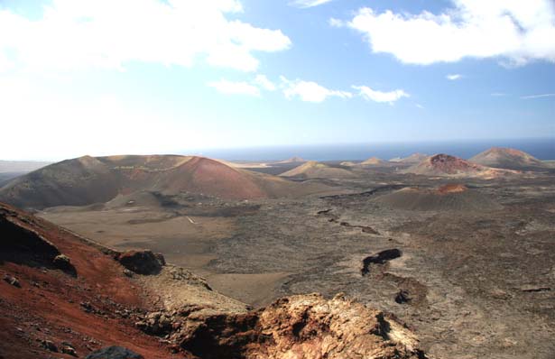
Timanfaya National Park, Fire Montains
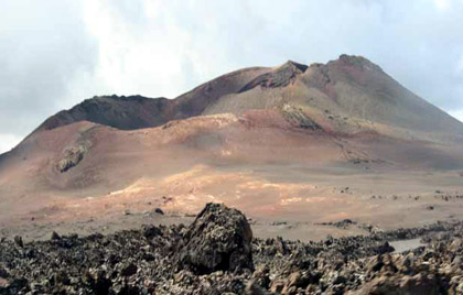
The volcano El corazoncillo
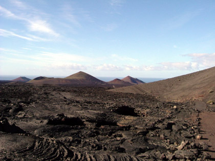
The powerful volcanic eruptions which occurred between 1730 - 1736 A.D. above all left their mark on the landscape, of Lanzarote. The last eruption, for the present, occurred in the summer of 1824 A.D. The Timanfaya mountain range and the Montanas del Fuego (the fire mountains) are situated at the centre of this eruption. This large area measuring 5107 hectares; its western border being the Atlantic, was declared a national park on the 9th August 1974, thereby maintaining it almost in its original state for future generations. This flat recently solidified landscape, as on the day of creation, consisting of craters and peaks, red oxidised tuff, further cinder flows and lifeless areas of black lava ash has been made accessible for tourists by a 14 km long road, the Ruta de los Volcanes. For this reason the Timanfaya National Park has become a vivid example of one of the most fascinating geographical occurrences on this earth: volcanoes.
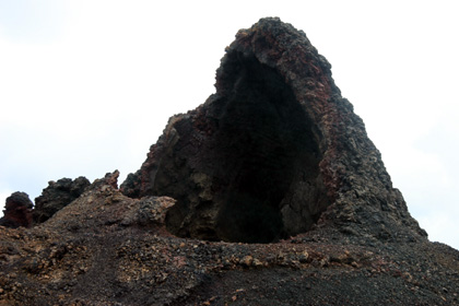
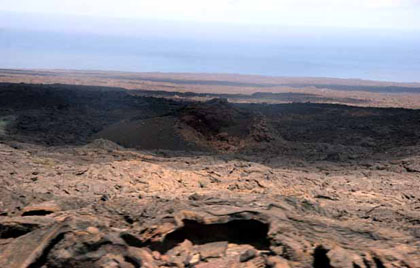
Volcanic mouth El Horno.
The most significant geological changes of Lanzarote occurred on December 1st 1730. More than a dozen craters opened up almost at the same time. A blanket of lava, 10 mtrs. thick, covered 11 villages, among them Tingafa, Mancha Blanca, Santa Catalina and Timanfaya, destroying an area of 200 km2 of the most fertile land. The consequences of that monstrous eruption, registered as one of the biggest in history, were still noticable in 1824. A mixture of liquid rock and gas was formed at 65 km below the earth. It was called «Magma» bellow the surface and «lava» on the surface.
Tunnel ol lavas.
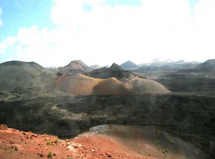
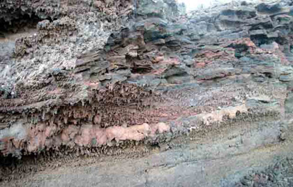
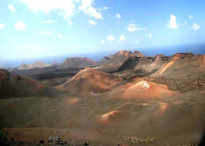
As this mixture was lighter than the massive rock it was surrounded by, it was pushed up through vertical channels, amassing in chambers or depositories at a depth of 3 - 5 km below the top of the volcanoes. The eruption arose when the pressure in those depositories became too high. High temperatures still occur in the fire Mountains in different areas reading between 100 and 400 degrees centrigrade at very shallow depths. But this heat is known as residual and is not related to «Magma». The most outstanding form of volcanic origin is the cone, which generally shows a crater in form of a boiler called «caldera». The solidified lava rivers are called «malpais». Their density varies between tufa, black basalt, light coloured pumice stone and «almagras», burnt red ochre land.
Caldera
The priest of Yaiza, Don Andres Lorenzo Curbelo, tried to express what he saw. Like all the populace he had to escape from the burning river and like all of them he remained on the island. He still couldn't know that these eruptions were going to go on for 6 years. Without interruption. From December 1730 until April 1736. «On December 1st 1730, between nine and ten in the evening, the earth suddenly opened up. A giant mountain raised itself, spitting huge flames which burnt incessantly for 19 days». After a few days, a new abyss opened. Immense lava rivers emerged from its interior covering Timanfaya Rodeo and a part of Mancha Blanca in its rage. It first advanced as fast as water, forming swirls, and then densely and heavily like honey, destroying villages on its way. With tremendous explosions new rock emerged from the earth and changed the direction of the lava westwards instead of northwards. It reached the villages of Macetas and Santa Catalina and demolished them. On September 11th 1731 the force of lava was renewed. It dispersed on Maso, burning and covering the village and finally reaching the sea causing dreadful explosions. This went on for 8 days, calming down at the end, appearently having ceased.
Tunnel and sea of lava.
But on October 18th another 3 abysses opened up at the top of the already covered village of Santa Catalina. Smoky clouds emerged covering the whole island, carrying ashes. Big water droplets fell everywhere. The people from Yaiza and the area around it had to escape more than once because of the darkness, ashes and smoke. But they came back realising that there would be no more destruction after that eruption. Ten days after that explosion all kinds of farm animals died. The fumes had asphyxiated them. From November 1st until November 20th smoke and ashes came out of the craters. On November 27th a new lava river descended form the mountain at high speed. It reached the sea on December 1st. It solidified forming an island and dead fish floated around. On December 16th the lava changed its course unexpectedly.
Drops of lava.
It now didn't flow towards the sea anymore, but southwestwards, burning down the village of Chupadero and devastating the fertile plain of Uga. Then it stopped and hardened. On January 7th 1732 new eruptions enveloped the old craters. The lava came out of two openings. Big smoky clouds accompanied it. Red and blue lightning flashed and it thundered. The inhabitants of the island were frightened because they didn't know what thunder was. On January 10th another mountain emerged from the earth desintegrating the same day. A rain of stones and ashes covered the whole island and the lava pushed its way crossing the «malpais» and reaching the sea. On March 7th several cones arose at the same time. Tingafa was destroyed. On June 4th three jets of fire exploded. The tremors, thunder and flames frightened the whole island. This occurred near Timanfaya, aproximately where the Fire Mountain is now. The openings joined forming one single huge crater . The lava crept towards the sea. Ashes and lightning arose from one of the craters and out of a second came a strange white vapour, which people had never seen before.
The road of volcanos.
The sea had boiled. New earth had been formed out of this bubbling mass. The island had grown. The solidified rocks and their metallic surface make us remember that disaster as if it had happened yesterday. A hundred volcanoes with 300 craters had spat out ashes and dust which the wind took as far as the islands of Lobos and Fuerteventura. The fertile plain of Tomara, a cereal centre and heart of the island and a dozen villages with 420 houses had been devoured by the lava. Only a century had gone by when in 1824 the earth opened up again for the last time and the plain of Tiagua disappeared under the solidified rock. Even today we can perceive the echo of that tremendous explosion. It is a landscape of unusual creation and its originality must be conserved.